
Brief
A central hub on Oregon State University's campus, the Memorial Union is a 300,000 square foot building with five different floors, containing everything from a ballroom, a bowling alley, and an art gallery, to spaces to relax and study, restaurants, meeting rooms, and offices. It receives an enormous amount of daily visitors who are often unfamiliar with the layout of the building, and need help finding where they need to go in the building.
During my time spent working in the Building Services department, I found visitors often asking me how to get to one area or another in the building. This helped me realize two things - firstly, that the building's size and complex layout made it a challenge for anyone unfamiliar to navigate it, and secondly, that the building's current wayfinding system was not doing a strong job in aiding visitors.
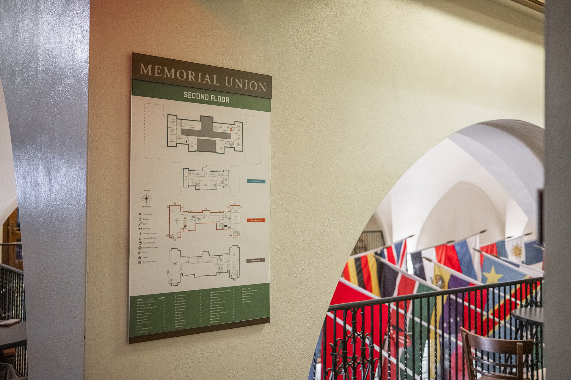
As I transitioned to a design role within the building, I was given the opportunity to redesign the building's wayfinding system, with the goal of creating one that would easily allow visitors to the building to find what they were looking for.
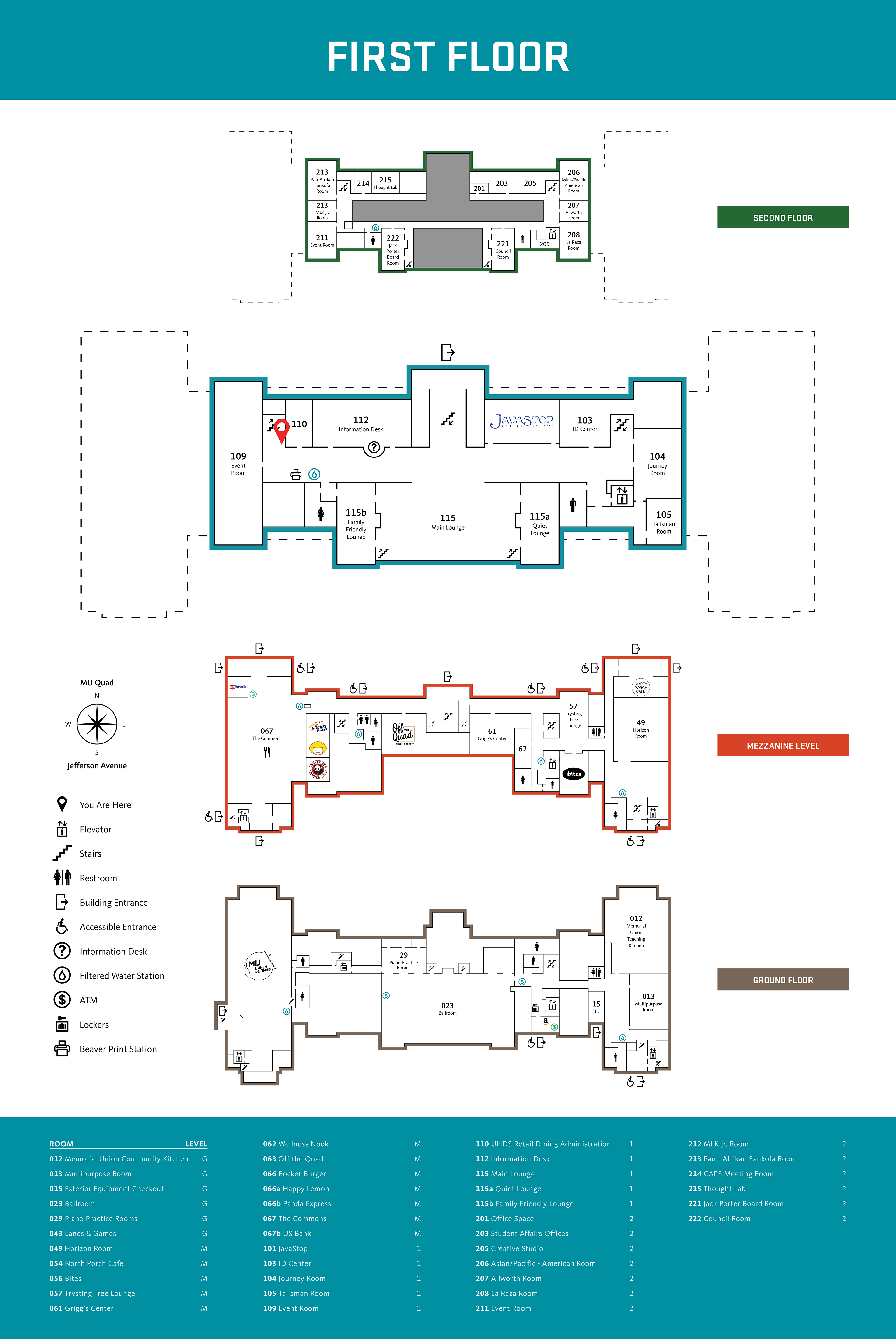
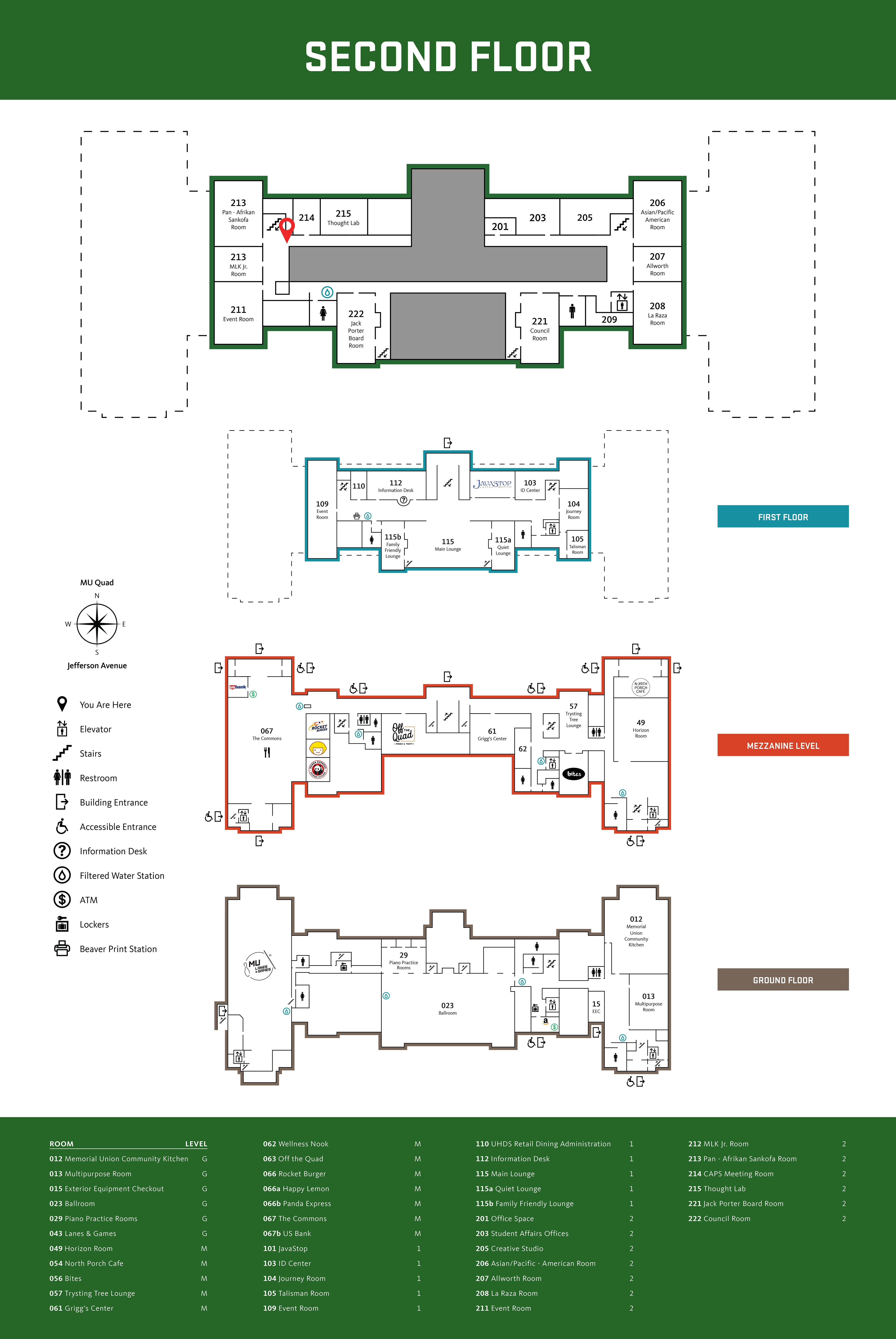
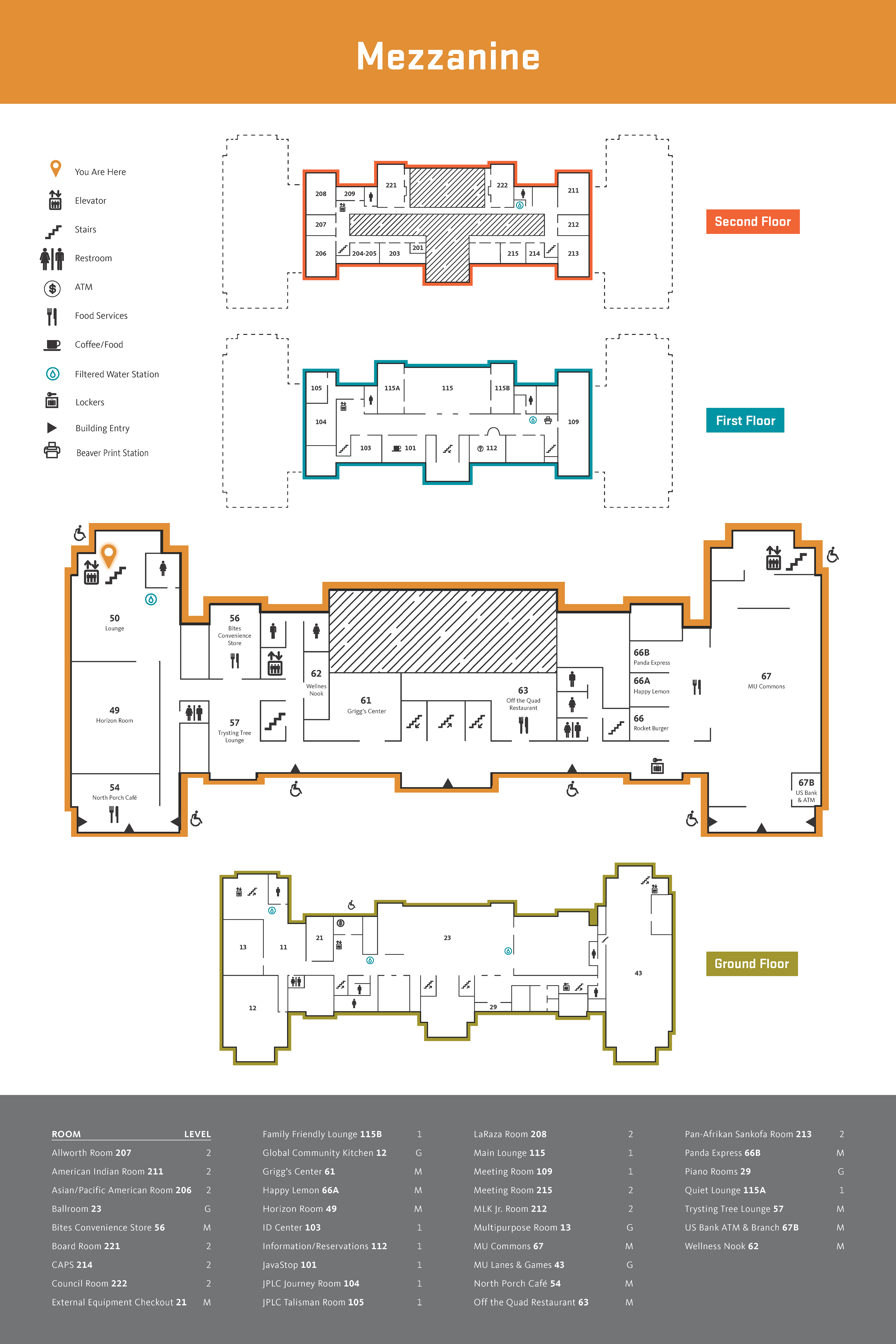
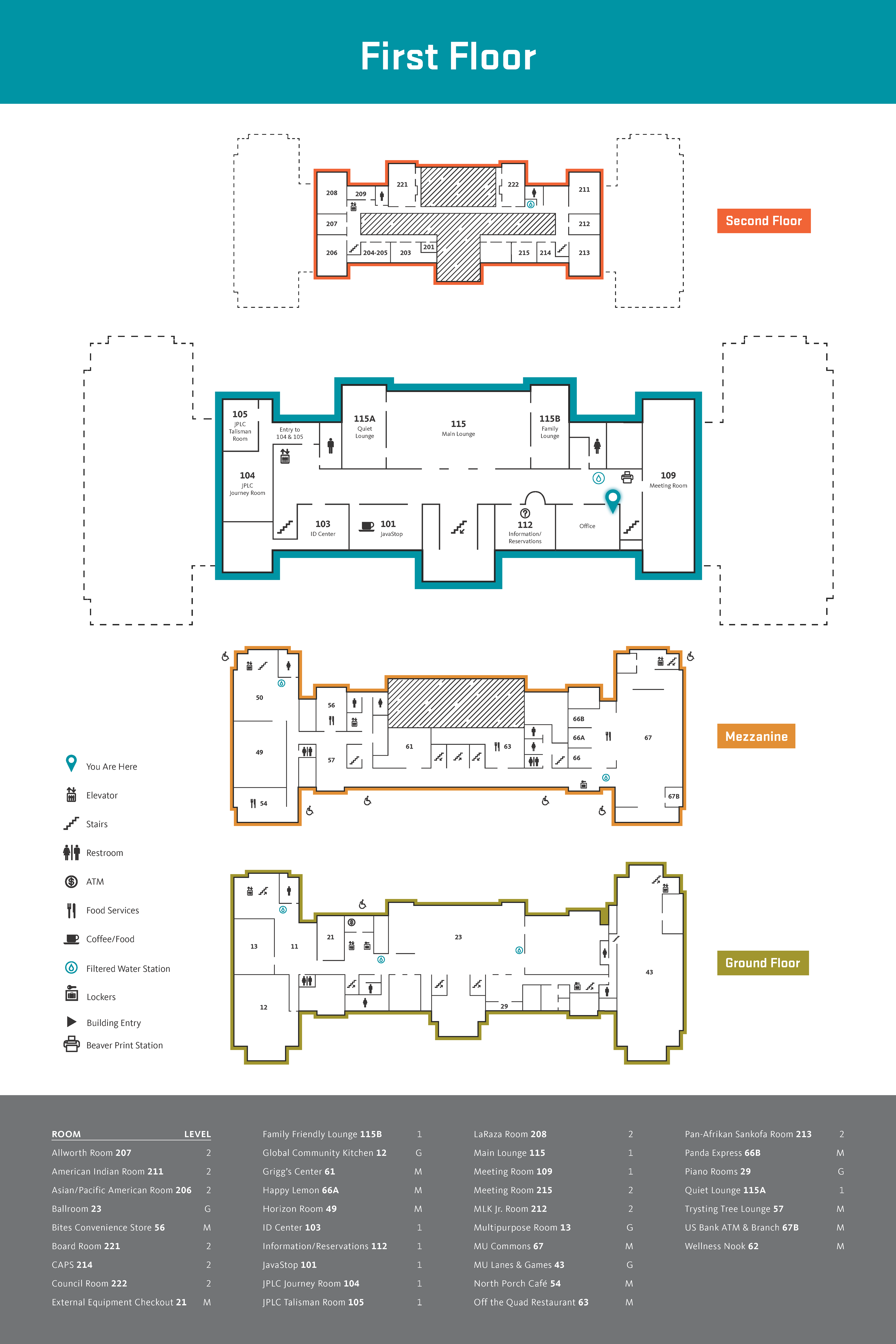
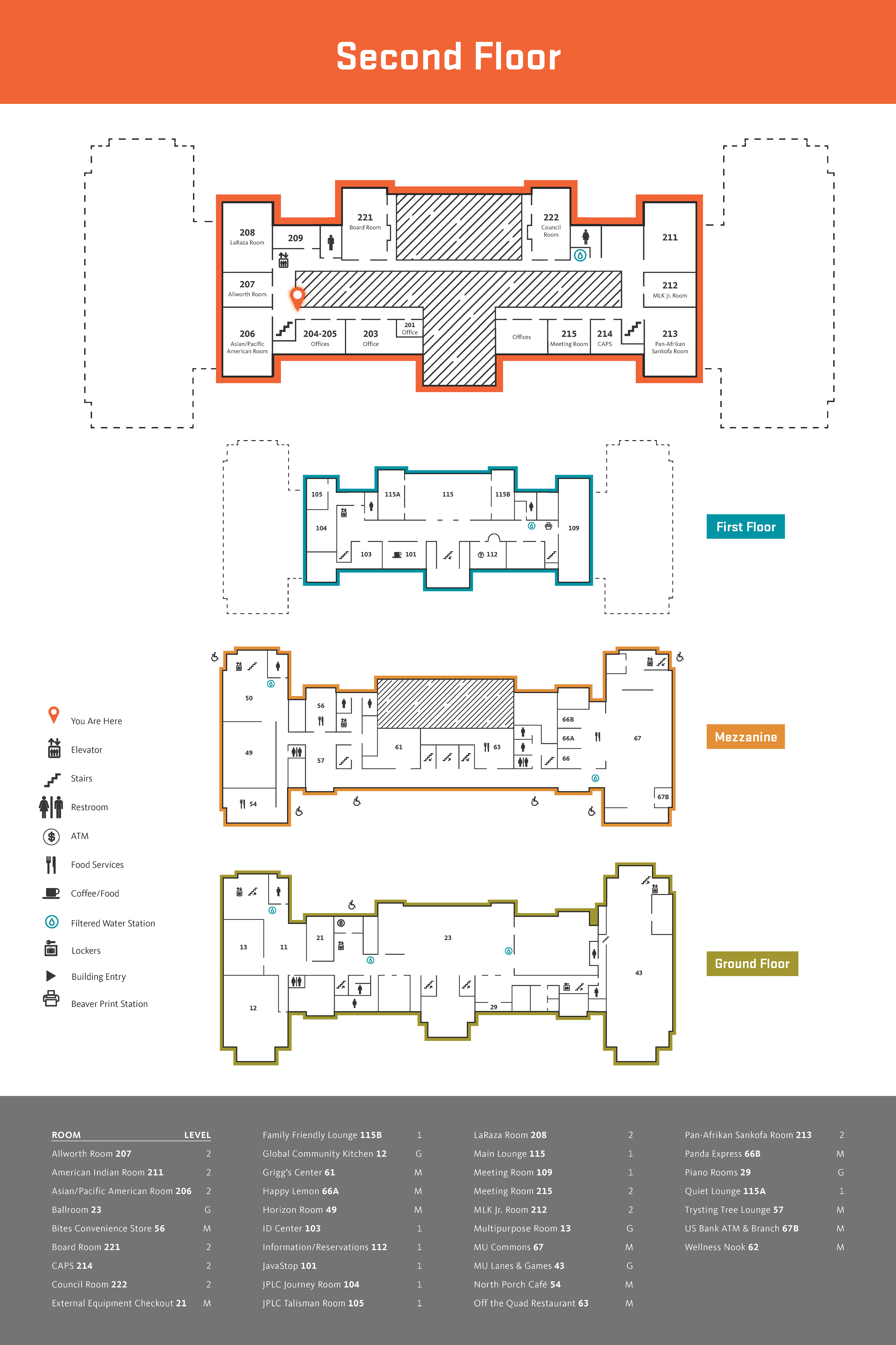
The final project deliverables consisted of 24x36 posters of the building maps to be displayed throughout the building on each floor. Each map highlighted the floor that it was located on through color and the size of each floorplan.
Project Development
Analyzing the existing building maps, I was able to identify several major problems. The maps didn't stand out visually throughout the building, the information on the maps was outdated, and the floorplan of the map was inaccurate or unclear in a significant enough way to cause confusion to anyone viewing it.
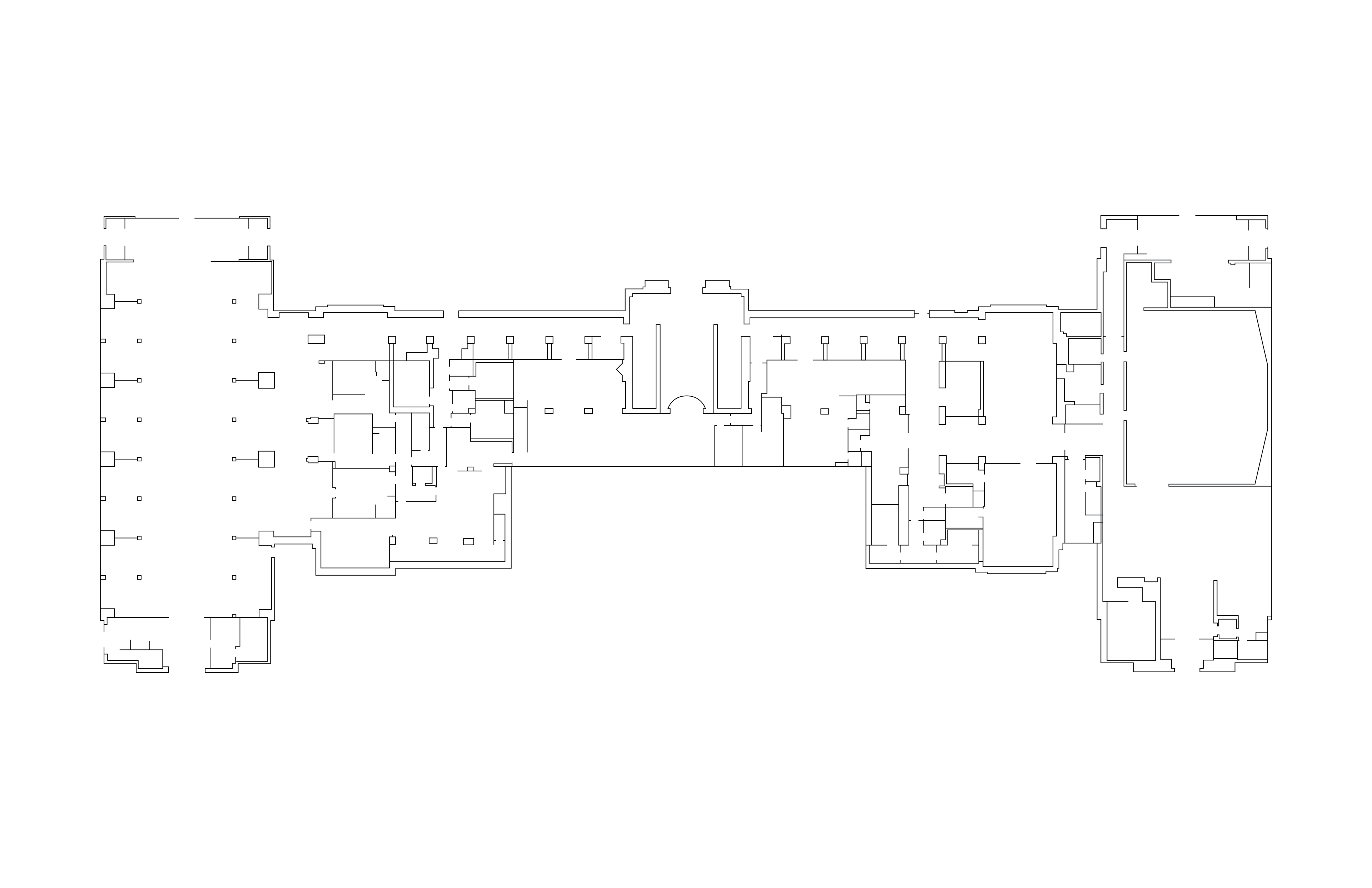
Rather than refining the existing map, I chose to rebuilt the map from the beginning. Using the building blueprints for reference, I created an exact floorplan. From there, I had to create a balance between exact floorplan accuracy and visual clarity and comprehensiveness. Here, I worked with the Guest Services and Building Services departments in the building to determine this balance, based on how visitors in the building navigated it and what they needed from the map.
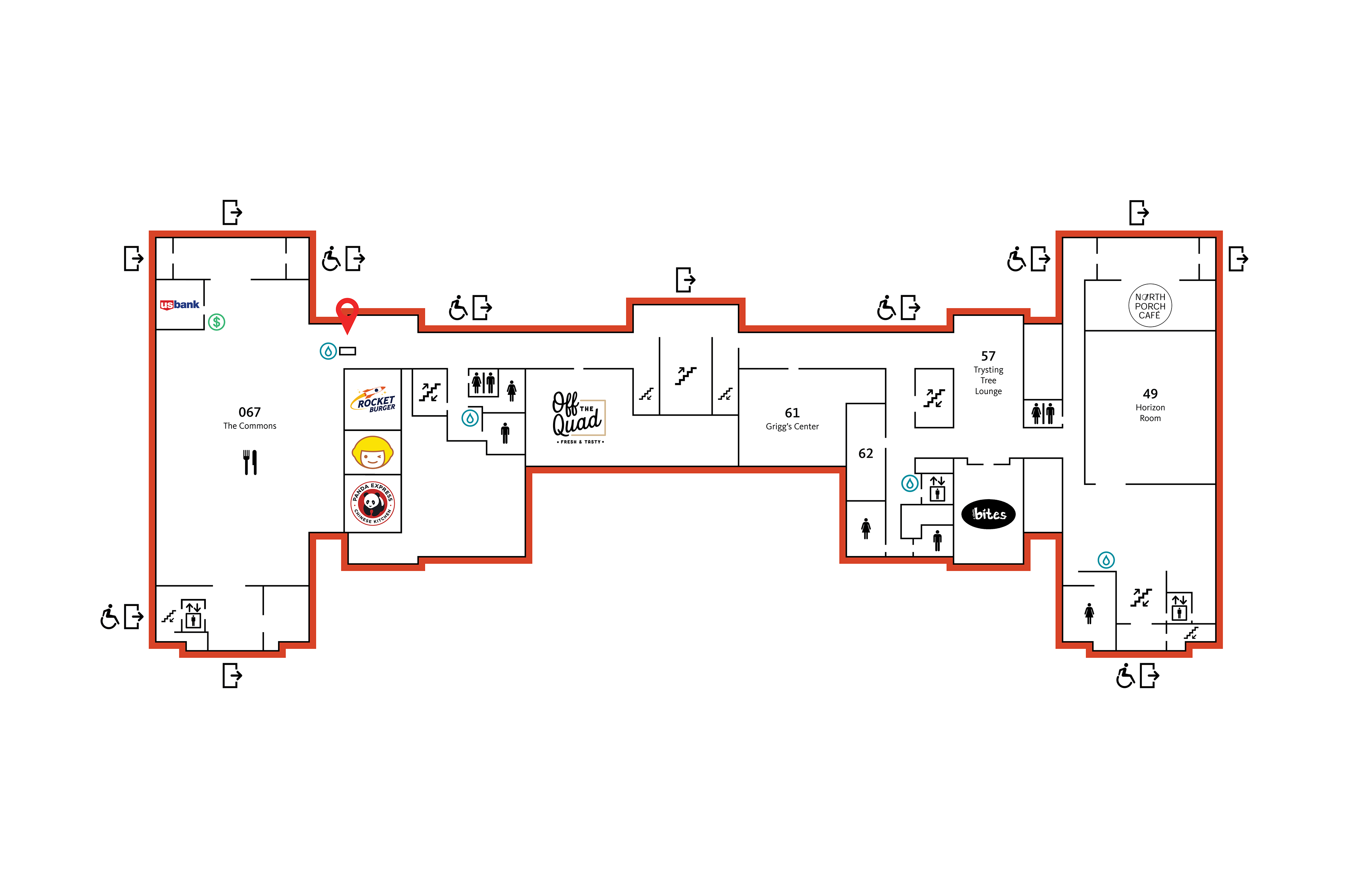
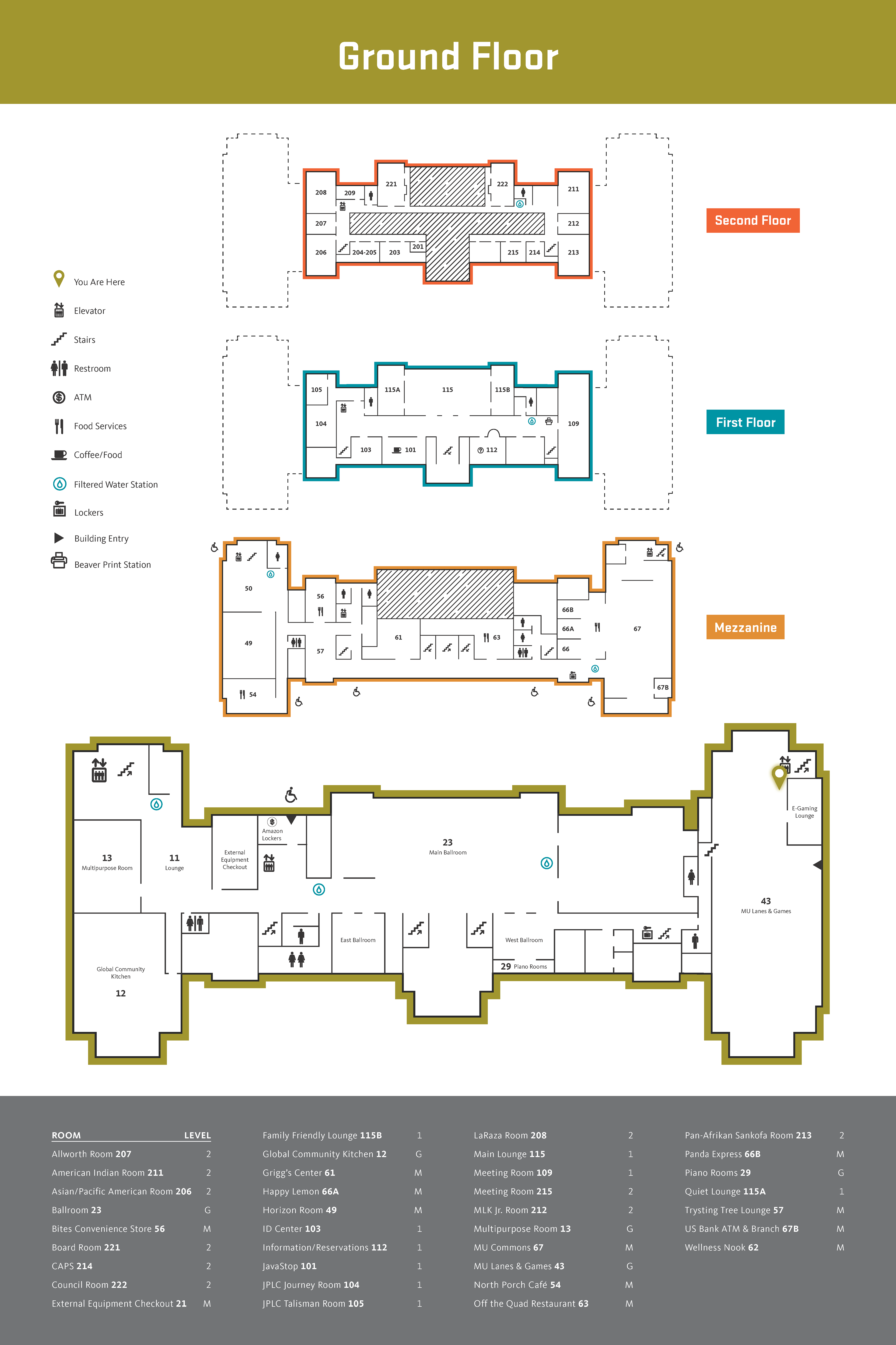
Below displays the process for the Mezzanine Level of the building - the same process was gone through for each additional level of the building - the Basement, Ground, First, and Second floors.

The floorplan was revised into its final state, displayed below, containing all the necessary icons, room numbers, and a floorplan that was both accurate and comprehensible. It was also stylized such that each level of the building was visually distinct from each other.
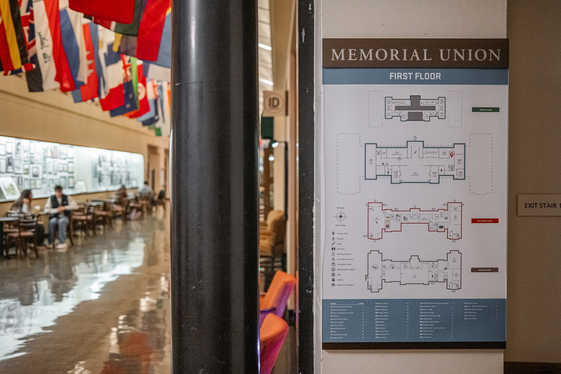
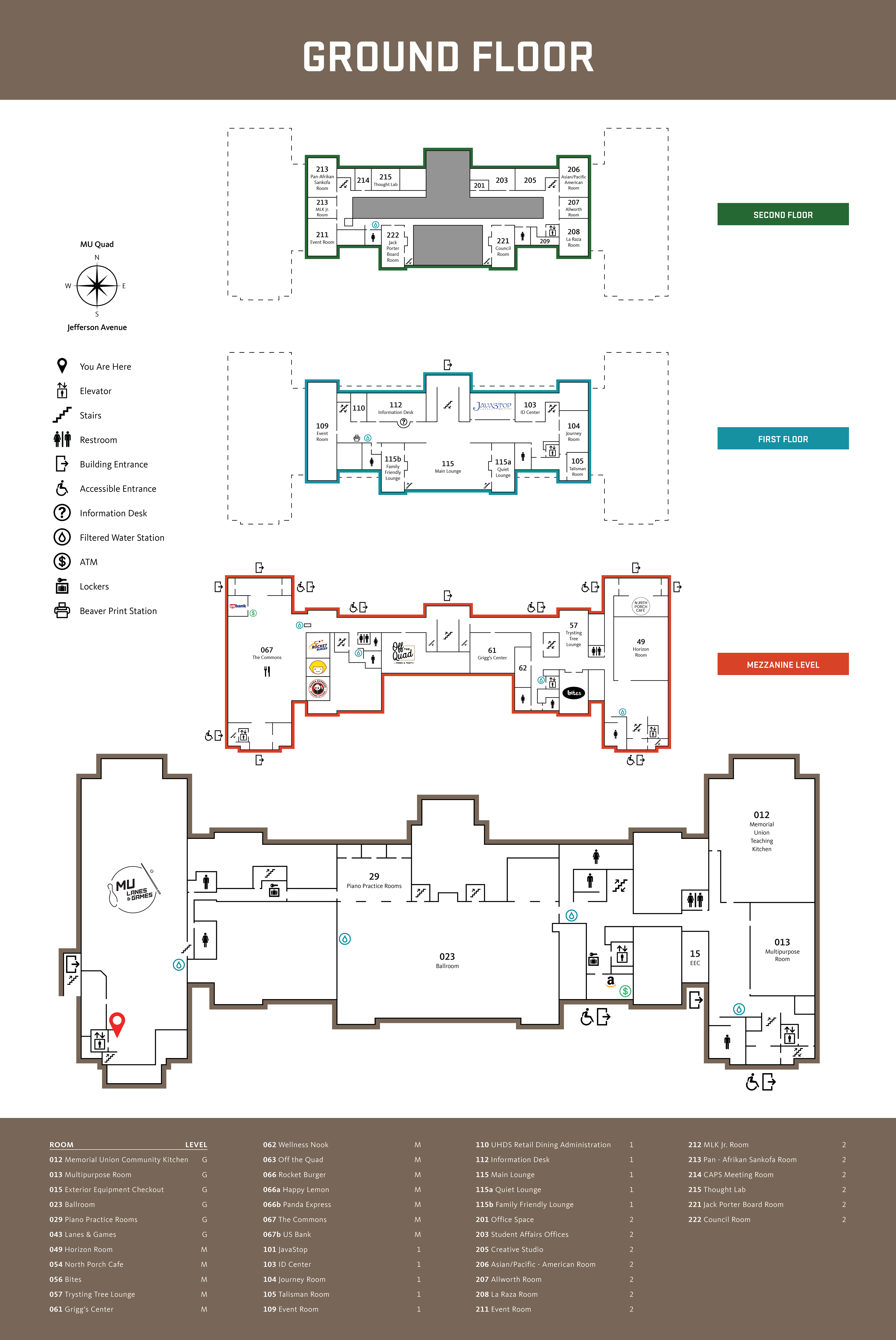
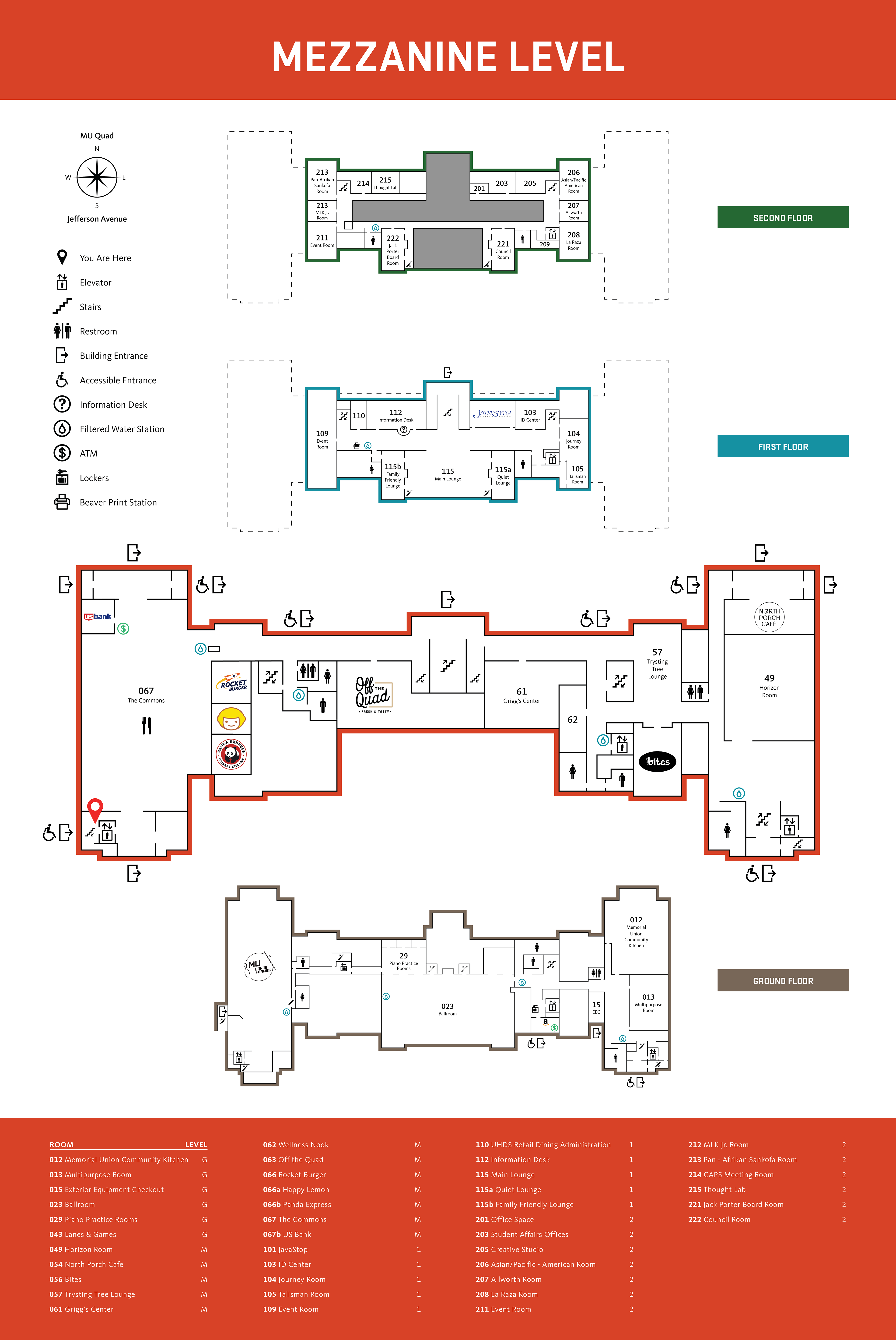
For display throughout the building, maps containing each floor as well as a list of rooms were made, with each map containing an indicator of where the viewer was in the building.